The Forecast: What NOAA Is Tracking
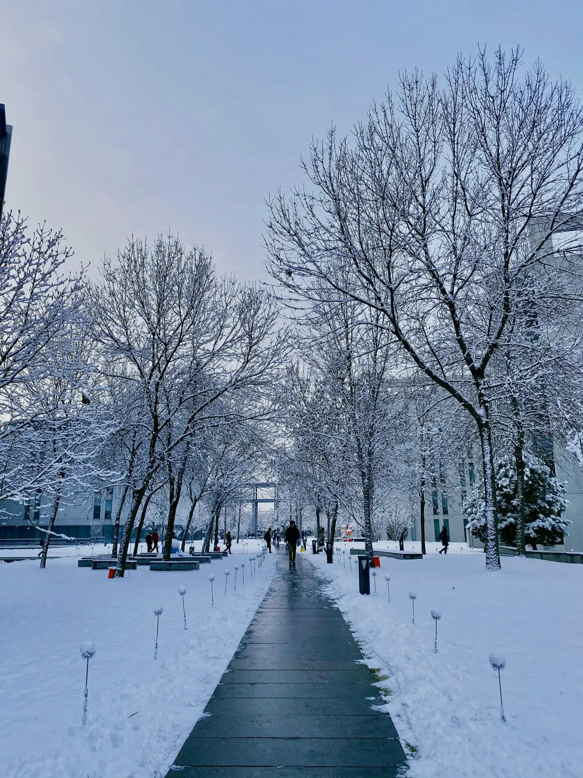
The National Oceanic and Atmospheric Administration (NOAA) Weather Prediction Center has issued guidance for a significant storm system moving into Colorado during the first week of May 2026. The system is expected to bring a combination of heavy wet snow, rapid temperature drops, and gusty winds to the Front Range and surrounding foothills.
Current models indicate 4 to 10 inches of snow accumulation across the Denver Metro, Douglas County, and Palmer Divide corridor between May 5 and May 7. Higher elevations along the foothills -- including areas near Castle Rock, Sedalia, Larkspur, and Castle Pines -- could see 8 to 14 inches. Overnight lows are expected to drop into the low 20s, well below freezing, before temperatures rebound into the 50s and 60s by mid-week.
This type of rapid freeze-thaw cycle is one of the most damaging weather patterns for Colorado landscapes and irrigation systems.
Why May Snow Is Different
May snowstorms are not unusual in Colorado. Denver has recorded measurable snowfall in May in more than 60% of years on record, and accumulating storms of 4 inches or more occur roughly once every three years. The latest measurable snow on record for Denver International Airport was June 12.
What makes May snow uniquely dangerous is timing. By early May, most properties have already:
- Activated irrigation systems: Water is pressurized in all lines, backflow preventers are open, and spray zones are running on schedule. A hard freeze with water in the system causes expansion damage -- cracked backflows ($300 to $800+ to replace), split lateral lines, and broken sprinkler heads.
- Completed spring planting: New annuals, perennials, and freshly planted trees have not established root systems yet. Temperatures below 28 degrees Fahrenheit kill tender new growth and can set back plantings by weeks.
- Started mowing schedules: Cool-season turf (Kentucky bluegrass, tall fescue) is actively growing. Heavy wet snow flattens turf, and the freeze-thaw cycle can cause crown hydration damage -- where water absorbed by the grass crown freezes and ruptures cell walls.
- Applied early fertilizer: Nitrogen-heavy spring fertilizer pushes new leaf growth. That soft new growth is the most freeze-susceptible tissue on the plant. A late freeze after fertilization can burn back weeks of growth.
Freeze-Thaw Cycles: The Real Damage Mechanism
A single night below freezing is manageable for most established landscapes. The real damage comes from rapid freeze-thaw cycling -- temperatures swinging from the 60s down to the 20s and back within 48 to 72 hours. This pattern causes:
Soil Heaving
Saturated soil freezes and expands, physically pushing shallow-rooted plants, newly installed sod, and landscape edging upward. When it thaws, gaps form beneath the root zone. Repeated cycles progressively displace root contact with soil, leading to desiccation and plant death even after temperatures normalize. This is especially common in clay-heavy Front Range soils.
Bark Splitting on Young Trees
Rapid temperature swings cause the south-facing bark of young deciduous trees to expand during warm daytime sun and contract when temperatures crash overnight. This mechanical stress cracks bark vertically -- a condition called "frost cracking" or "southwest injury." Once the bark is compromised, insects and disease gain entry. Trees planted within the last two to three years and trees with thin bark (maples, fruit trees, honeylocusts) are most vulnerable.
Irrigation Component Failure
Brass fittings on backflow preventers, PVC pipe above the frost line, and exposed valve assemblies all crack when water inside them freezes. A single overnight freeze event in a pressurized system can cause $500 to $2,000+ in repair costs across a commercial property. Properties that activated irrigation before May 1 without freeze monitoring in place carry the highest risk.
What Property Owners Should Do Right Now
With the storm expected within the next 48 to 72 hours, take these steps immediately:
1. Suspend Irrigation Schedules
Turn off all irrigation controllers or activate the rain delay function for at least 72 hours. Do not simply skip one cycle -- the system needs to remain fully off through the freeze event and the thaw period following it. If your system has a master valve, close it to depressurize the mainline.
2. Protect the Backflow Preventer
Your backflow preventer is the single most expensive irrigation component at risk. Wrap it with an insulated cover, towel, or blanket secured with zip ties or tape. Do not use plastic sheeting alone -- it traps moisture against the brass and worsens freeze damage. Purpose-built insulated covers are available at hardware stores and irrigation suppliers for $15 to $30.
3. Cover Tender Plantings
Newly planted annuals, recently installed perennial beds, and any container plants should be covered with frost cloth, burlap, or bed sheets before temperatures drop. Plastic sheeting can be used as an outer layer but should not contact plant tissue directly -- it transfers cold. Remove covers once daytime temperatures return above 40 degrees.
4. Avoid Walking on Frozen Turf
Frozen grass blades are brittle. Foot traffic on frozen turf snaps grass crowns and leaves visible damage tracks that persist for weeks. Keep foot and vehicle traffic off turf areas until the snow has melted and the ground has thawed.
5. Inspect After the Thaw
Do not restart irrigation until temperatures have been above freezing for a full 24 to 48 hours. Before pressurizing the system, visually inspect:
- Backflow preventer housing for visible cracks or water seepage
- Exposed pipe runs for splits or bulging
- Valve box interiors for standing water or displaced components
- Sprinkler heads for tilt, breakage, or failure to retract
Run each zone individually and walk the property looking for geysers, low-pressure zones, or water surfacing where it should not be. These are signs of underground line fractures.
How JLS Is Responding
JLS Landscape and Sprinkler actively monitors NOAA forecasts, National Weather Service advisories, and local station data for all managed properties across Denver Metro and Douglas County. When a freeze event is forecasted:
- Irrigation suspension: We suspend all irrigation schedules across managed commercial properties 24 to 48 hours before the expected freeze event. Controllers are set to rain delay or turned off at the master valve.
- Pre-storm verification: Our team verifies that systems are off and not running overnight into freezing conditions. We confirm controller status at every managed site.
- Post-storm inspection: After the event passes and temperatures stabilize above freezing for 24 hours, we conduct visual inspections of backflow preventers, exposed components, and landscape beds before restarting any irrigation.
- Damage documentation: Any freeze damage is documented with photos, and repair quotes are provided same-day when issues are found. This allows property managers to file insurance claims promptly if applicable.
- Snow response: If accumulations reach contractual trigger thresholds, our snow and ice management crews deploy for plowing, shoveling, and deicing on commercial properties. We maintain 24/7 weather monitoring during storm events -- the same infrastructure used for winter snow operations.
This integrated approach is one of the advantages of working with a company that manages both landscape irrigation and snow operations year-round. We are already monitoring weather 24/7. A May storm is not a surprise -- it is part of the operating plan.
Why May Storms Matter More Than People Think
Late-season snow events tend to be dismissed as minor inconveniences because they melt quickly. The snow is gone by afternoon, so property owners assume no damage occurred. In reality, the damage from a May freeze-thaw event is often worse than mid-winter conditions because:
- Irrigation systems are pressurized and vulnerable (in winter, they are blown out and empty)
- Plants are actively growing with soft new tissue (in winter, they are dormant and hardened off)
- Soil is saturated from spring rain and snowmelt, maximizing heave potential
- Property managers have shifted focus from winter operations to summer preparation and may not be monitoring freeze forecasts
The properties that avoid costly damage are the ones that have a plan in place before the storm arrives. If you manage your own irrigation, set a reminder to check NOAA's 7-day forecast every morning through May 15. If you work with a landscape management company, confirm they are monitoring weather and have a freeze protocol.
Historical Context: Colorado May Snow Events
Colorado's climate data shows that May snow is part of the normal pattern along the Front Range, not an anomaly:
- May 2019: Denver received 3.5 inches on May 21, the latest significant accumulation in recent years
- May 2017: A spring blizzard dropped 6 to 12 inches across the metro, snapping tree limbs already in full leaf
- May 2013: 4.2 inches fell in Denver on May 1 and 2, with up to 8 inches in Castle Rock
- May 2003: 3 inches in Denver, heavier in the foothills, with overnight lows in the teens
Denver's average last freeze date is May 4, but the latest recorded freeze was June 8, 2007. Planning for the "average" is planning to be caught off guard half the time.